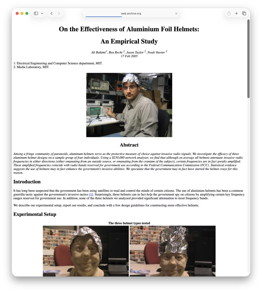
One from the archives; what are the effects of tin foil hats on radio wave propagation in the head? The results may just shock you!
A Little More Web Kipple
One from the archives; what are the effects of tin foil hats on radio wave propagation in the head? The results may just shock you!
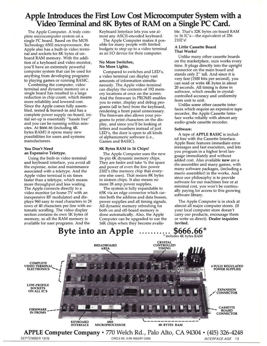
Retro Computer Adverts has a rather special post to celebrate the 50th anniversary of Apple’s founding; a look at their first – and probably most important product – the Apple 1.
The British Geological Survey has an interesting article on the moving alignment of true, magnetic, and grid north and how it’s about to leave England for the next several hundred years.

]
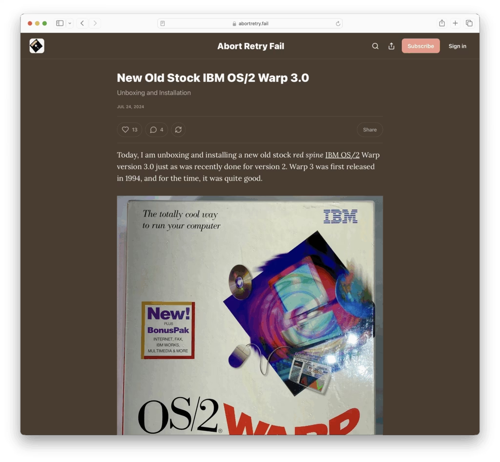
Abort Retry Fail has a really nice post on opening and installing a new old stock Red Spine release of OS/2 Warp 3.0.
Now, while I’ve played around with OS/2 Warp 4.0 and 4.52 as part of Period Sites in Period Browsers, Warp 3.0 is not one I’ve yet reached.
And how uncanny it looks! Familiar but alien. Windows 3.1 but not. I should really get an instance of this up and running just so I can really feel – rather than just see – the differences between how I expect it to work and how it does work…
Anyway, I strongly suggest going and having a read of the article and a look at the pretty pictures.
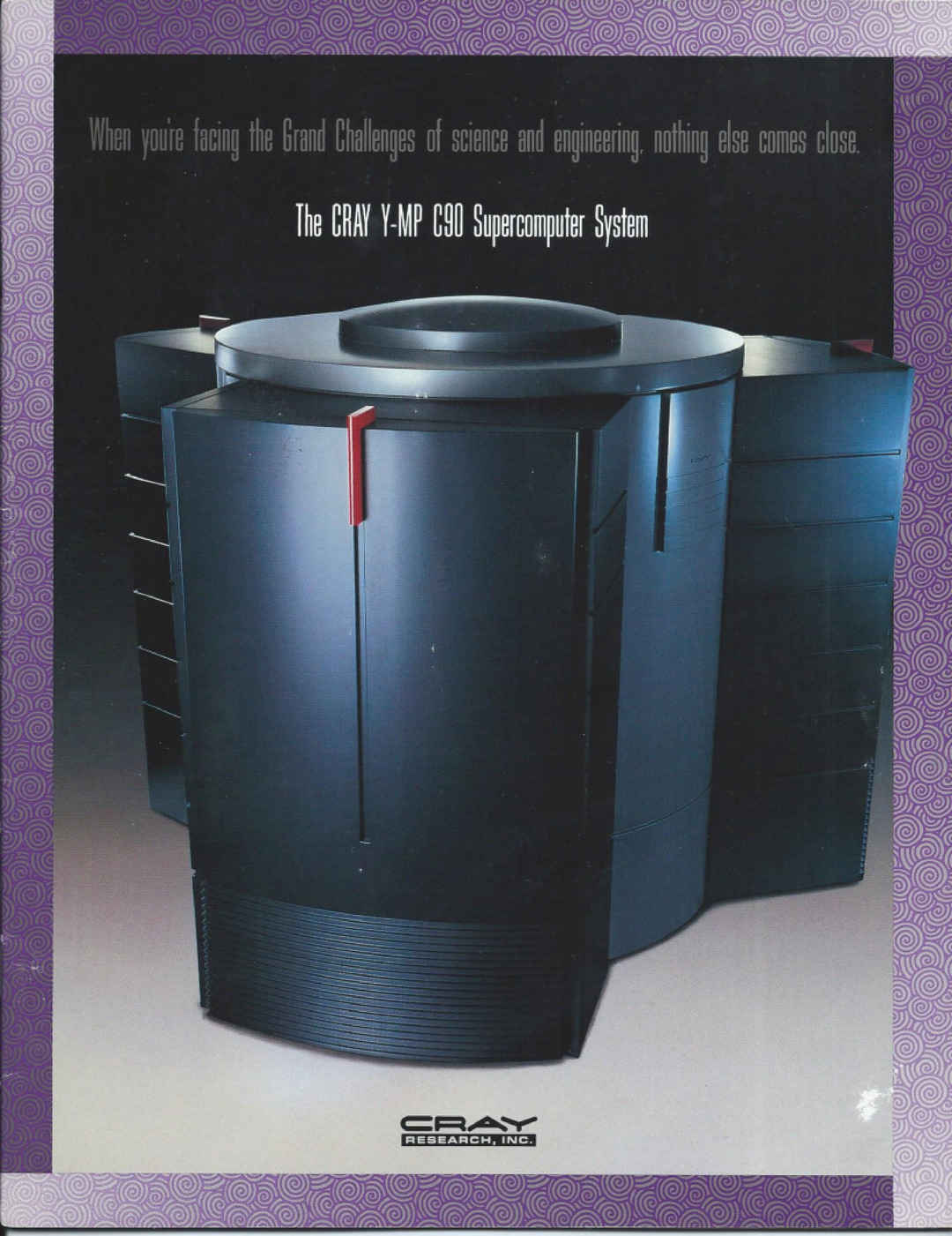
It’s the start of the month and over at Retro Computer Adverts there’s a rather lovely brochure for the Cray Y-MP C90 in all of it’s early 1990s glory.
Quanta Magazine has a nice article on a question I’d not even thought about – can all shapes pass through themselves? And, apparently, the answer is ‘no’, but only for a very limited number of shapes.
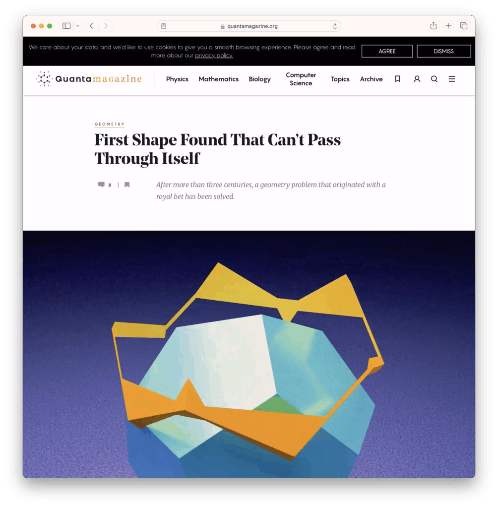
The article is pretty good and breaks down the problem and its history quite nicely. Go read!
And now for something really rather fab to start your day off with – ICT 1301 resurrection project! Their goal is to restore the UK’s oldest 2nd Generation Electronic Stored Program Computer to functioning order.
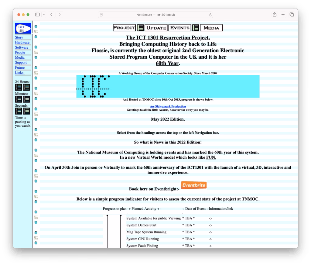
They also have a lovely set of digitised technical manuals up to view!
Fab!
Another one that (currently) doesn’t seem that easy to Google (even though it should be!)
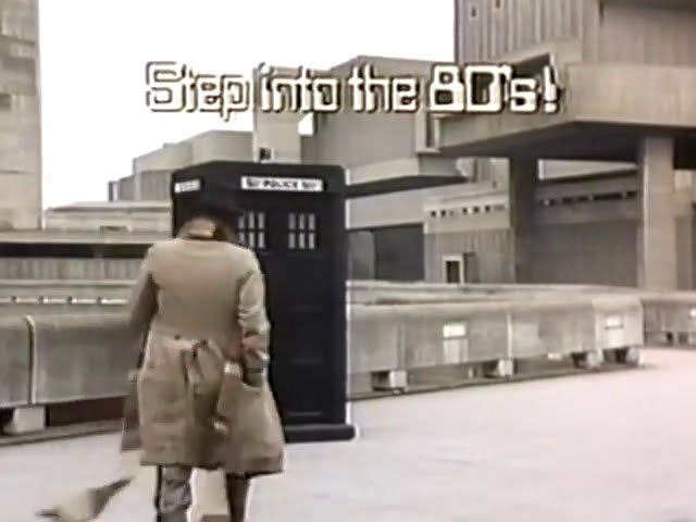
And here’s a rather nice pair of Doctor Who-themed adverts for the Prime Computer range of minicomputers. There are so fairly obvious hints that Tom Baker and Lalla Ward are phoning it in but the shoutout to their current – but brief – marriage is rather nice.
Imagemagick (available from all good package managers) has the ability to split a .pdf file into a set of numbered images via the following incantation…
convert -quality 100 -density 200 -colorspace sRGB <PathToPDF> -flatten <PathToOutputDirectory/>Page-%02d.jpeg…where, of course, ‘%02d’ represents the auto-numbering element of the incantation.