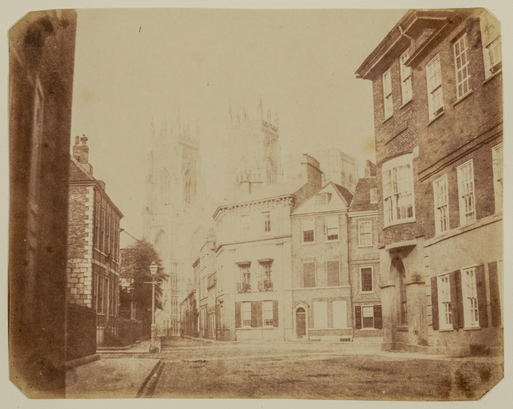
Whilst poking around on Getty.edu’s art search site I managed to stumble on this fascinating but sadly poor photograph of what is now the junction between Museum Street, St Leonard’s Place, Duncombe Place, and Blake Street. The photos current location can be seen on the StreetView below.
As you can see, the Getty version of this image is more than a little blown out. However, a little more hunting presented me with this; the same image – in far better quality – from the US’s National Gallery of Art.
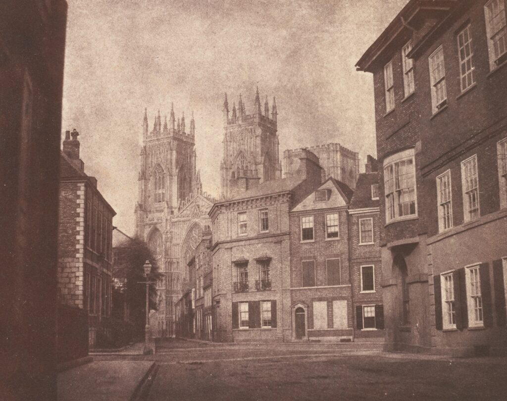
And what a fantastic image it is! There are very few photographs of York from before 1850 and this one is in a lovely condition.
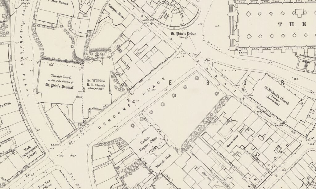
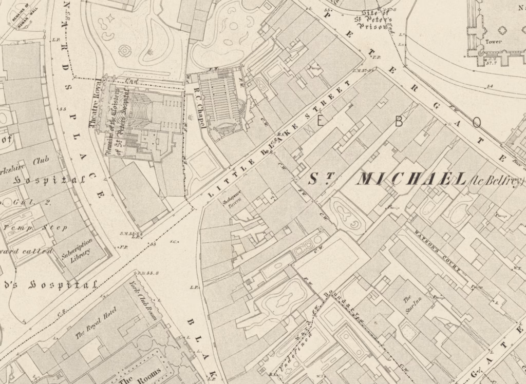
While the name ‘Lop Lane’ can be traced back at least as far as the 1200s, shortly after this photograph was taken Lop Lane ceased to be Lop Lane and became Little Blake Street – as can be seen on the Ordnance Survey map below.
In 1864 Little Blake Street was then widened from around 15ft wide to almost 100ft wide. In 1880, it was renamed to Duncombe Place in memory of Augustus Duncombe as can be seen in on the Ordnance Survey map below.