And onto another Tour of Old York. This time our video comes courtesy of the British Pathe YouTube channel and brings us two and one quarter minutes of footage of York shot between 1930 to 1939.
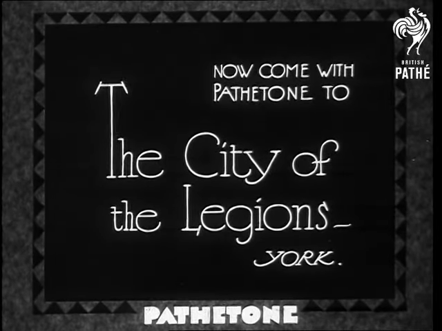
‘The City of Legions – York’
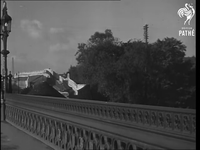
South of Skeldergate Bridge
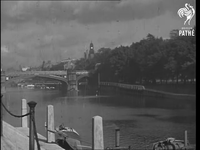
Taken on the Ouse’s west bank, south of Skeldergate Bridge and looking north up the river, we can see both Skeldergate Bridge and the clock tower of York Magistrates court. Though now known as Terry Avenue and lined with flats, at the time this video was filmed this area was a riverside wharf. To the right and behind the trees – where the modern St George’s Fields car park would be situated – would have been the site of York Baths. Built in 1877, York Baths were York’s first public baths and the building would remain there, in an ever increasing state of decay, until it’s demolition in 1972. To the left would have been a mixed site containing of a boatyard, a confectionary works, and a chemical manure works.
Coney Street
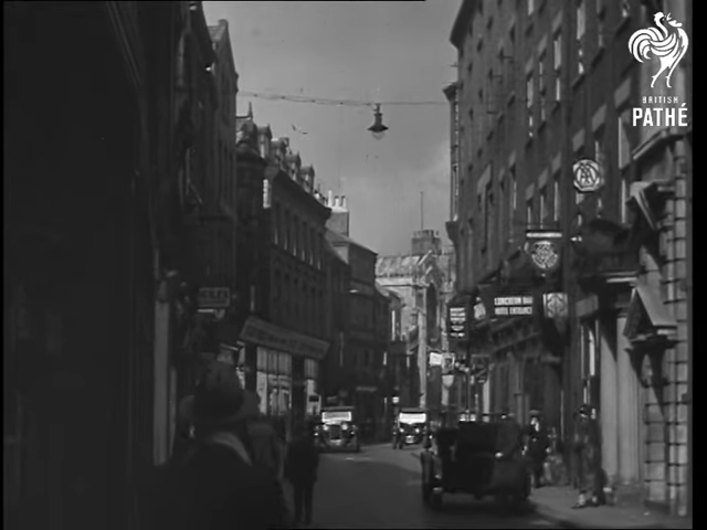
Coney Street facing north. On the right is the pre-cast concrete of 46 Coney Street. Built in 1922-23, this building was originally built for the The Yorkshire Penny Bank and is now inhabited by VirginMoney, a successor organisation. Next to no. 46 is the Coney Street frontage of no. 44, ‘The Black Swan Inn’ – an historic coaching inn with a history stretching back to the 17th Century. By 1955, the remains of ‘The Black Swan Inn’ had been demolished to make way for a department store.
In the far distance is the church of St Martin le Grand. Damaged in 1942 ‘Baedeker Raid‘ bombings, this church was never fully rebuilt and the upper level and stained glass window are now lost to Coney Street.
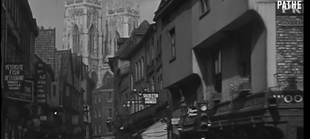
The Corner of Low Petergate and Goodramgate
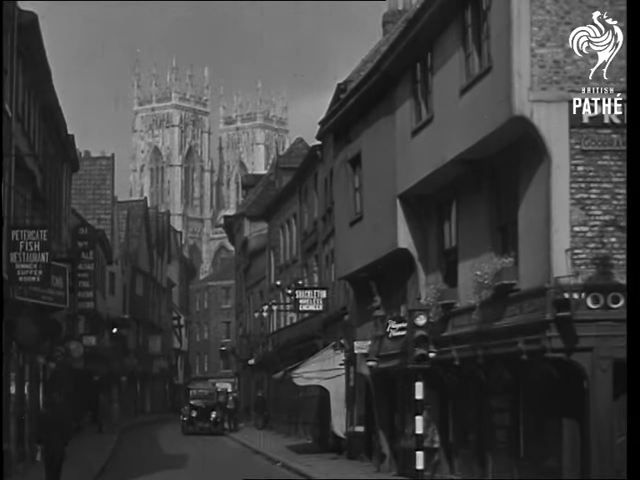
Taken at the west end of Low Petergate with the Minster firmly in the background. To the immediate right is a three-storey timber-framed building built in the early 17th century. Slightly further back and to the left is an 18th century brick building originally constructed as a house. During the 19th century this was converted to a shop and, by the 1930s had become the Petergate Fish Restaurant. Today this fish restaurant survives as Drake’s Fish & Chips. It is believed that the route of Low Petergate follows the principle route into York’s Roman fortress.
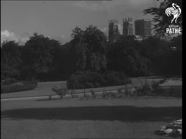
Memorial Gardens on the south side of the river looking north-east towards the Minster. To the left, just out of frame, is the 1924 War Memorial which, at this point, would have been solely dedicated to the Great War. Prior to it’s use as a green space and then war memorial, this site housed elements of York’s N.E.R coal store and a tool manufacturing plant.
North Eastern Railway Headquarters
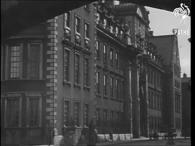
Filmed from just under the 19th century breach of the city walls, this is the west side of what is now The Grand Hotel. Build between 1900 and 1906 as the North Eastern Railway Headquarters, at this time the main entrance would have faced the site of York’s old railway station. Just to the right is the site of the North Eastern Railway War Memorial – something which survives to this day.
Views from around Lendal Bridge
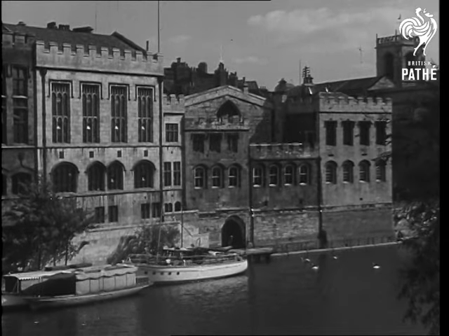
The Guildhall, filmed from the west side of Lendal Bridge.
The north side of Lendal Bridge. In the foreground is North Street Postern Tower – also known as Barker Tower – a 14th century tower and the anchor point for the west end of the northern Ouse blocking chain. Restored in 1930, prior to this Barker Tower had been repurposed as a mortuary.
Behind and to the left is Lendal Tower. This tower was the anchor point for east end of the northern Ouse blocking chain. During the 1930s this tower was converted into offices.
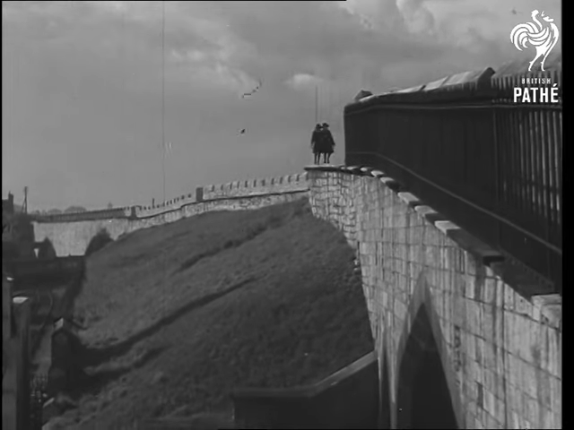
Cliffords Tower and the Prison Walls
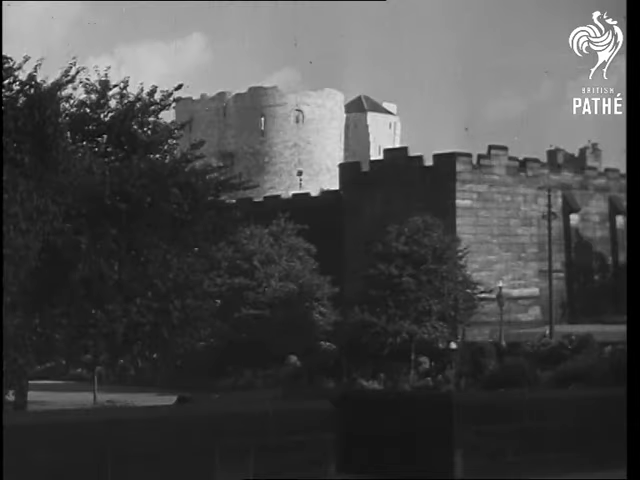
Clifford’s Tower taken from Tower Gardens. At this point in Clifford’s Towers existence it formed part of York Prison and an element of the prison’s outer curtain wall can be seen between the park and the tower. These walls – along with the majority of the prison complex – were demolished in 1935. On the right hand side you can see one of the tall poles that supported the electric cabling of the tram network.
Walmgate Bar
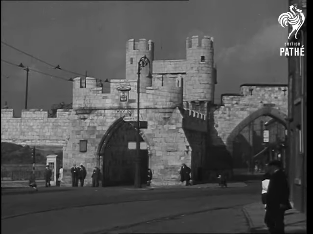
Walmgate Bar facing east. This particular version of the Bar was constructed in the 14th century however a previous building was documented as far back as the mid-12th century. The larger gateway on the right hand side of the picture is a mid 19th century reconstruction of a smaller gateway. This reconstruction was performed to improve accessibility to the east side of the city. Running through the centre are the supports and wires for part of the York tram and trolleybus service. This tram service was replaced with a bus service during the mid-1930s and the infrastructure for the tram network was removed shortly afterwards.
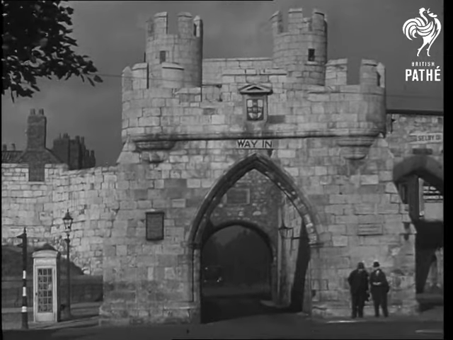
The southern portal of Walmgate Bar. This sits on a 29 mile route from Brough-on-Humber to York that had been in use since at least the Roman period. The A1079 (as it’s now know) remains an important route across the east of Yorkshire to this day.
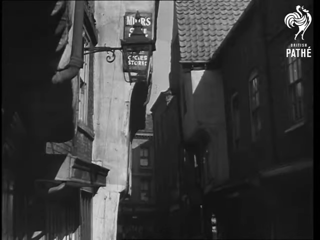
The Shambles
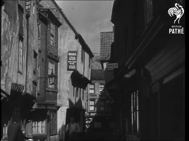
The Shambles looking north-west towards what is now Kings Square. I’ve not been able to find much information on the fate of ‘Muir’s Cycle Depot‘ (to the left) or the ‘Hall’s‘ store to the right.
At the the north-west end of the Shambles stands 5 and 6 King’s Court. The front of this building was rebuilt during the 1950s and now contains various offices.
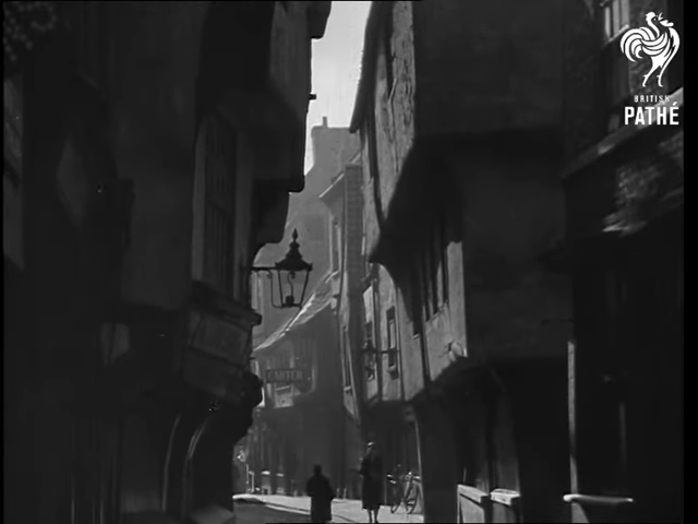
The Shambles looking south east towards Pavement. The thick sills below the ground floor windows would have, originally, been used to display cuts of meat ready to be sold.
College Street
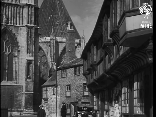
On the right is St William’s College which is overlooked by the Minster’s East End and Chapter House. Built in 1465 for the training of the chantry priests of York Minster, by the mid-1930s St William’s College had passed through a period of commercial use before it was repurchased in 1902 for use as a meeting place for the Convocation of the Province of York. At this time the structure was refurbished and reworked by Temple Moore into a layout more suited to a meeting space.
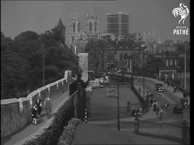
Lendal Bridge and the Walls
Lendal Bridge looking south-west. Built between 1861 and 1863, Lendal Bridge replaced one of York’s ferry services. During the early 19th Century North Eastern Railways had planned to build a railway bridge at this location, however the City of York Corporation successfully managed to block the project. It the far left you can see the tall obelisk of the North Eastern Railway’s War Memorial.
Further south west. In the bottom right you can see the Station Road railway arch that carries the road to the modern station. On the left you can see some track elements of the older first station and the far right side of the North Eastern Railway’s War Memorial.
A view north-west from approximately the same location as above. In the background stands the Minster with it’s central tower under repair. In front of the Minster stands River House; built in 1868, it was designed by CJ Parnell for The Yorkshire Club. In the centre is Lendal Bridge with some tramway tracks just visible on the approach. On the left is the Station Avenue arch in the historic walls. Build in the 19th century, this arch replaced Tower 18 of the walls.
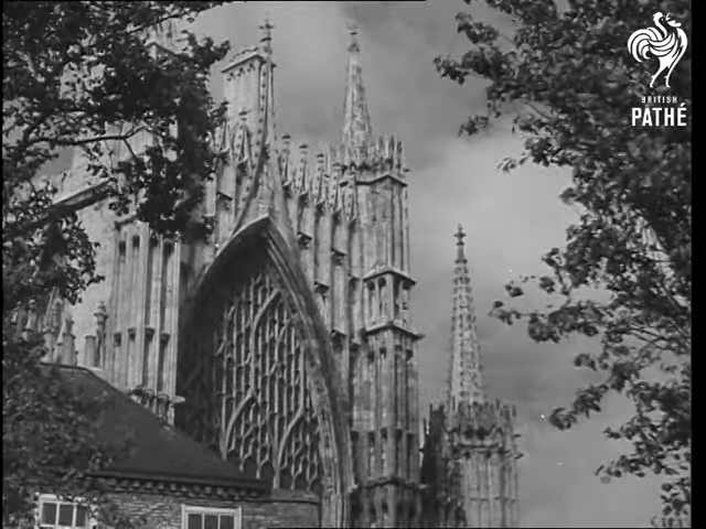
York Minster
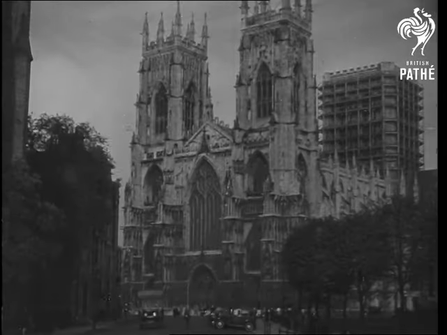
York Minster as shot from Duncombe Place. To the right – shrouded in trees – stands G.F. Bodley’s 1905 memorial to the South African/Second Boer War.
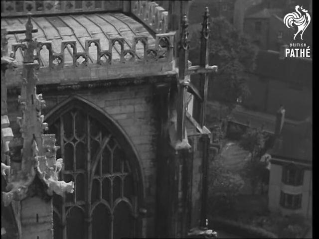
The top of the Great East Window, taken over the shoulder of 6 Minster Yard. Built between 1405 and 1408, the Great East Windows is Britain’s largest medieval stained-glass window. By this point a second layer of glass had been added to the outside to protect the original stained glass from the effects of weather and pollution.
On the right is 7 Minster Yard. Originally built in the early 18th century as a clergy house, it was restructured in the 19th century and is now a private residence. To the left is part of one of the Minster’s smaller, secondary wings.
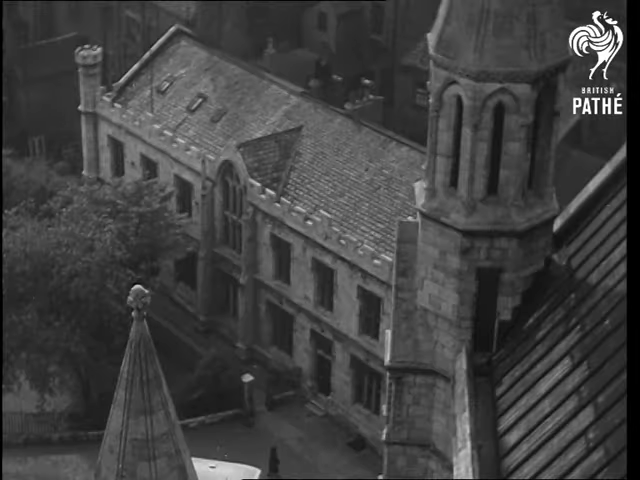
A view down from the roof at he south west end of the Minster towards 8 and 9 Minster Yard. Built in 1837 to a design by J. P. Pritchett for use as a pair of houses, by this point they formed an element of the Minster School.
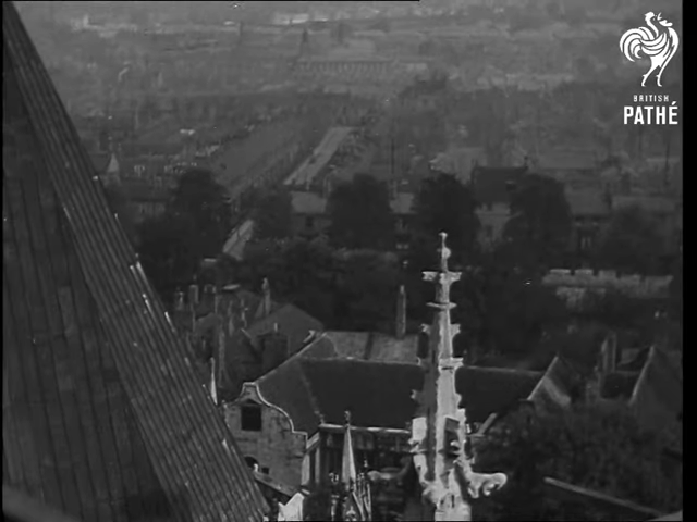
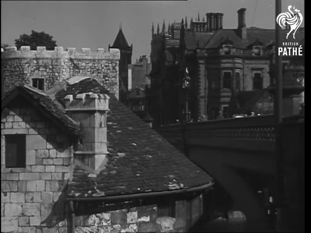
A view from the north-eastern roof of the Minster. In the foreground is the ‘H’-shaped building known as the The Treasurer’s House. Now a National Trust property, this build was originally built in the 16th century, with further work and restructuring performed in the 17th and 18th centuries. To the left is the conical roof of the Chapter House. To the centre-right you can catch a glimpse of the City Walls. Behind – and just outside the city wall – runs the long terrace of houses that makes up St John Street.
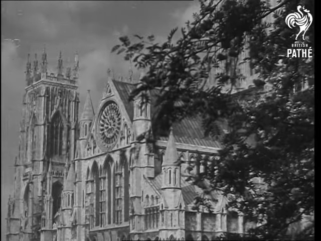
The south side of York Minster. The large stained glass Yorkshire Rose window that sits in the south transept was original commissioned in the 15th Century to mark the end of the Wars of the Roses. During the 1984 fire the glass in this window cracked but fortunately the retaining lead didn’t melt and it’s panes did not fall.
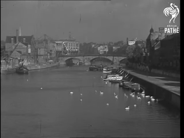
The River Ouse looking north from Skeldergate Bridge towards Ouse Bridge. Built between 1879-81 as a toll bridge, Skeldergate bridge was the last of the three core road bridges in central York to be built. The site of Ouse Bridge has been used for at least three (Viking, Medieval, current) – possibly four (Roman) – bridges over at least the last millennia and a half. The current bridge was completed in 1821. To the right is the South Esplanade, to the left – just before Ouse Bridge – is Queen’s Staith. Queen’s Staith – as show here and as it exists today – is a product of the 19th century Victorian construction however a Staith has been located on this site since around 1305. On the left behind the bridge you can see 17 Bridge Street. Originally built in 1911 as a department store, this now houses restaurants, shops, and offices. Behind Ouse Bridges’ centre arch you can see the south-east face of The Guildhall.